WP0: Scientific guidance & coordination for activity integration (Lead: UNIBO, Co: All URs) [Start: M1 – End: M24]
Objectives
O0.1 Providing scientific guidance to the project
O0.2 Guaranteeing a proper coordination and integration of project activities
O0.3 Sharing information between URs
Tasks description and coordination
T0.1 (Lead: CNR-IRPI)
Project coordination and agenda
Rs coordination group
Project agenda
T0.2 (Lead: CNR-IRPI, Co: UNIBO, UNIMORE)
Steering committee
Steering committee composition
Steering committee agenda
T0.3 (Lead: CNR-IRPI)
Information/data sharing
Cloud repository set up
OGC compliant Spatial Data Structure (SDI) implementation
T0.4 (Lead: UNIMORE, Co: CNR-IRPI, UNIBO)
Co-production activities and writeshops
Study sites identification based on optimal data, analyses and instrumentations settings
Co-production field activities planning
Co-production data elaboration analysis and synthesis planning
Thematic writeshops organization
Results
R0.1 Coordination group identification
R0.2 Shared project agenda
R0.3 Steering committee identification
R0.4 Project cloud repository
R0.5 Spatial Data Structure (SDI)
R0.6 Thematic writeshops
Collaborating/Integrating WPs
WP 1,2,3 and 4
WP1: Hillslope sediment sources and estimation of sediment supply to the drainage network (Lead: UNIBO, Co: UNIMORE, CNR-IRPI)[Start: M3-End: M22]
Objectives
O1.1 Estimating the multi-temporal and event-based rates of landslide sediment supply to the drainage network in the study areas
Tasks description and coordination
T1.1 (Lead: UNIBO, Co: UNIMORE)
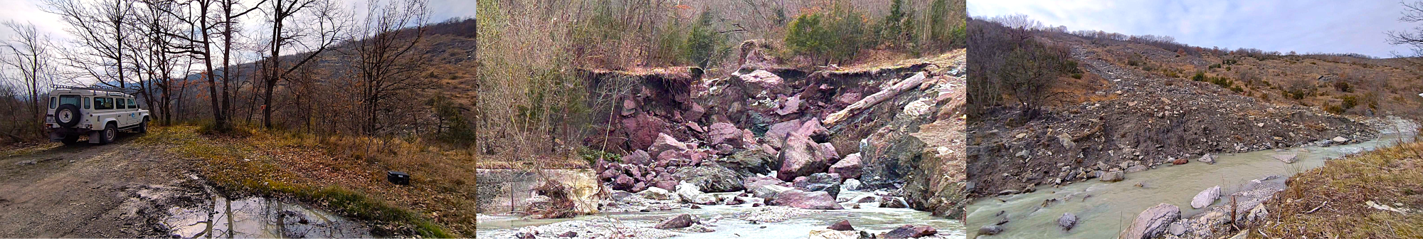
Landslide mapping and volume characterization
Compilation of basin-wide landslide inventories (i.e., multi-temporal and post-extreme event)
Landslide characterization through field-based and UAV-based surveys
T1.2 (Lead: UNIMORE)
Susceptibility mapping of landslide sediment supply/sources
Spatial predictive model based on statistical relationships between training dataset of recent landslides source areas and geologic, morphometric and hydrological predisposing factors
Validation of spatial predictive model using validation dataset of recent and historic landslides sources
Assessment of potential landslide sediment supply/sources
T1.3 (Lead: UNIBO, Co: CNR-IRPI, UNIMORE)
Evaluation of landslide sediment supply to the drainage network
Analysis of frequency-size landslide statistics and uncertainty evaluation
Building area-volume empirical models and uncertainty evaluation
Estimation using empirical relations of volumetric rates of landslide sediment supply to the drainage network
Analysis of dynamics of sediment entrainment and deposition along landslide tracks
Results
R1.1 Multi-temporal airphoto-based landslide inventories
R1.2 Event airphoto-based landslide inventories with identification of the sediment sources
R1.3 Areal visibility thresholds across land cover and survey/imagery types, for (i) landslide detection, and (ii) landslide sediment delivery to stream
R1.4 Landslide sediment supply/sources susceptibility maps
R1.5 Landslide area-volume empirical relations
R1.6 Multi-temporal rates of landslide sediment supply to the drainage network
R1.7 Guidelines for assessing landslide sediment supply to stream channels
Collaborating/Integrating WPs
WP 2 and 3
WP2: Advanced techniques for evaluating geomorphic change and sediment transfer (Lead: UNIBO, Co: UNIMORE, CNR-IRPI) [Start: M4 – End: M22]
Objectives
O2.1 Testing/advancing mapping/monitoring techniques and technologies for comprehensive and spatially/temporally accurate estimations of sediment pathways and sediment transfer from hillslope to drainage network, and sediment monitoring along streams (bedload and suspended sediment)
Tasks description and coordination
T2.1 (Lead: UNIBO, Co: UNIMORE, CNR-IRPI)
Monitoring of landslide sediment transfer to streams and in-stream sediment dynamics through proximal sensing
Ad hoc 3D mapping with UAV-based photogrammetry and LiDAR campaigns
T2.2 (Lead: UNIBO, Co: CNR-IRPI)
Bedload monitoring in coupled and uncoupled conditions
Continuous water discharge and seismic (i.e., geophones) monitoring at instrumented stations
Characterization of channel bed, surface and subsurface grain-size distribution (GSD)
Bedload monitoring using RFID tracers
Geomorphic Change Detection via thresholded DoD analysis of sequential UAV-derived DSMs/DTMs
T2.3 (Lead: CNR-IRPI, Co: UNIBO)
Suspended load monitoring through remote sensing: testing and empirical calibration
Continuous suspended load (i.e., SSC) monitoring (i.e., turbidimeter) and direct sampling for calibration
Remotely-sensed data collection
Testing of remote sensing spectral turbidity algorithms and comparison with continuous monitoring and direct sampling
Feasibility of using high-revisiting time multispectral sensors for SSC monitoring
Results
R2.1 Proximal and in situ monitoring datasets
R2.2 Channel bed texture (GSD) and surface roughness in coupled and uncoupled conditions
R2.3 Particle entrainment thresholds in coupled and uncoupled conditions
R2.4 Sediment budgets from particle tracking and thresholded DoD analysis
R2.5 Evaluation of the feasibility of SSC measurements through remotely-sensed data
R2.6 SSC time series and datasets
R2.7 Updated 3D maps of the study areas
Collaborating/Integrating WPs
WP 1 and 3
WP3: Modelling sediment transport and connectivity (Lead: CNR-IRPI, Co: UNIBO, UNIMORE) [Start: M8 – End: M222]
Objectives
O3.1 Developing/Testing/Upgrading methods for modeling sediment transport and connectivity along basins, hillslopes and drainage network.
Tasks description and coordination
T3.1 (Lead: UNIBO, Co: CNR-IRPI)
Structural connectivity modeling
Geomorphometric indices estimation
Geomorphometric thresholds identification
T3.2 (Lead: UNIMORE, Co: UNIBO, CNR-IRPI)
Modeling sediment transport and connectivity at the drainage network scale
Parameterization/Characterization/Calibration of CASCADE model
CASCADE validation and sensitivity analysis
Exploring basin-scale sediment connectivity using the calibrated CASCADE model
CASCADE simulations for management applications
T3.3 (Lead: CNR-IRPI, Co: UNIBO)
Distributed modeling sediment transport and connectivity at hillslope/basin scale
Applying/modifying/testing LANDPLANER model
Estimation of the dynamic sediment connectivity
LANDPLANER scenario-based simulations for studying sediment dynamics for real/plausible basin management scenarios in response to varying natural and/or anthropogenic forcing
Results
R3.1 High- and low-resolution versions of the digital drainage network for all study areas
R3.2 Area/slope-based geomorphic thresholds of disturbance for all study areas
R3.3 IC-based envelopes across different types of sediment sources, sinks, and geomorphic barriers
R3.4 Model outputs based on field-parameterized (i.e., Landslide sediment supply, GSD, and bankfull width) model runs for selected basins of the study areas
R3.5 Identification of currently problematic channel reaches, including those that will become problematic under deteriorated anthropogenic and climatic forcing scenarios
R3.6 Calibrated LANDPLANER model version
R3.7 Estimates of dynamic connectivity in the study areas
R3.8 Estimates of hillslope to drainage network sediment export in different geo-environmental contexts
R3.9 Guidelines/Workflow for modeling sediment transport and connectivity
Collaborating/Integrating WPs
WP 1 and 2
WP4: Dissemination & Outreach (Lead: UNIMORE, Co: UNIBO, CNR-IRPI) [Start: M3 – End: M24]
Objectives
O4.1 Summarizing the findings of WP1-5 and translating them into high-profile scientific outputs and disseminating the results among specialized and general audiences
Tasks description and coordination
T4.1 (Lead: CNR-IRPI, Co: UNIBO, UNIMORE)
Web and social media
Project web site and social media accounts implementation
Dissemination of project results and key findings through the URs webpages, social media and through the project website and social platforms
T4.2 (Lead: UNIMORE, Co: UNIBO, CNR-IRPI)
Conference contributions and open access scientific dissemination
Presentations at least at two major international conferences in geology/geomorphology, soil erosion and soil science
Prepare articles with open access licenses to impacted scientific journals
Publish project datasets elaborated through national and international open access data repository
Metadata and data public exposition though the project OGC compliant SDI
Publish methods in open access methodology journal
T4.3 (Lead: UNIBO, Co: UNIMORE, CNR-IRPI)
Summer school and workshops on “Sediment dynamics and management”
Year 2: International summer school for MSc and PhD students on monitoring techniques
Year 2: Workshops for regional land managers and stakeholders
Results
R4.1 Project website
R4.2 Visible and active website and social media posts
R4.3 At least 4 contributions to international conferences
R4.4 At least 2 papers in high-rank impacted journals
R4.5 Open access project datasets
R4.6 Public datasets on SDI and WebGIS
R4.7 Technical notes on data collection methods
R4.8 Summer school and workshop organization
Collaborating/Integrating WPs
WP 0,1,2 and 3
