Background
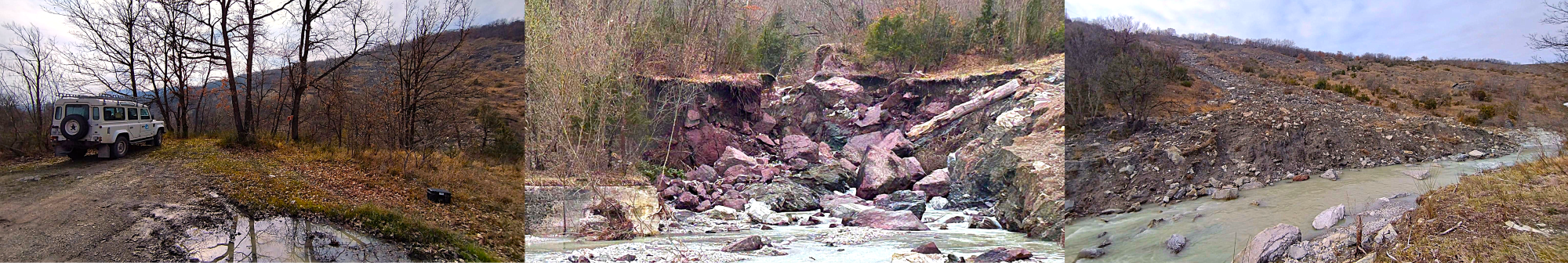
Channel morphology and fluvial dynamics are mainly controlled by the rate and timing of sediment supply in relation to local transport capacity [1-3]. Sediment supply to mountain streams is typically dominated by landslide sediment inputs, which can dictate channel bed geometry and texture, while altering fine sediment dynamics [4]. Depending on river lateral confinement and the magnitude-frequency of hydro-meteorological events, landslides can deliver sediment slugs to tributary confluences, or directly on alluvial flood plains, causing severe channel changes [5,6] and inducing largely unknown downstream effects on fluvial sediment transport. Although the importance of hillslope-channel coupling on basin sediment dynamics has long been acknowledged [7-10], the overall process of sediment transfer across landscape components, and the associated disturbance-cascade [11] remains poorly understood. This is a critical gap, particularly for transitional systems such as Intermontane fluvial corridors, which export sediment from mountain belts out to unconfined foreland and eventually to the sea [12,13].
In active tectonic settings, such the Northern Apennines, the contribution of intermontane fluvial systems to orogen unloading makes them critical players in the feedback mechanisms linking subaerial erosion and tectonic uplift (e.g. [14]). From an applied perspective, sediment dynamics along intermontane fluvial systems have long been affected by human activities. On the one hand, they have been historical sources of gravel for construction works; on the other, gravel mining and the construction of engineering structures for flood protection have largely disconnected these rivers from their natural sinks, inducing channel bed incision and canyon development ([15,16]). Considering their basic and applied relevance, a quantitative appraisal of how landslide sediment supply affects the geomorphic functioning of intermontane fluvial systems of the Northern Apennines is critical for understanding, hence modeling, inherent transient responses, as well as for ensuring sustainable sediment management. Progress in this direction can be made via landslide studies that evaluate empirically the volumes and rates of sediment transfer [17,18], delivery to streams [19-21], and relevant effects along the drainage network. We believe that only integration of field-based, proximal and remote sensing technologies may support such research needs. In field studies, even when sediment delivery to streams is estimated, due to inherent logistical difficulties, the effects on fluvial sediment transport remain largely unknown, as these have been considered in a handful of cases at the reach scale and over short periods [22,23]. At the basin scale, existing models of fluvial transport typically lack a realistic, empirically-based, landslide sediment-supply component [24].
On the hillslopes and along stream channels, geomorphic changes can be detected by differencing repeat high-resolution DEMs, complemented by uncertainty analysis [25]. In channel reaches, this approach can be integrated by particle tracking for an improved monitoring of bedload [26] that characterizes pebble to boulder-sized particle dynamics as a function of water discharge, hydrograph shape, and channel boundary conditions [27].
Suspended load related to landslide occurrence, and/or reworking of existing deposits [28,29], may be detected and monitored through remote sensing, particularly during extreme events. These methods, which are largely experimental [30-32], currently show lower accuracy compared to direct measurements [33,34]. Progress in this sense could provide spatially-distributed estimates of suspended sediment concentration, a key information to identify active landscape components, such as badlands. A quantitative appraisal of badlands’ erosional contribution, which in the Northern Apennines are major sources of fine sediment [35], is critical for assessing land degradation, predicting dam siltation and adopting sustainable management strategies [36].
Recent conceptual developments on the notion of sediment connectivity [37-40], defined as the propensity of a geomorphic system to favor the transfer of sediment, through structural (forms and materials) and functional (sediment fluxes) linkages among its building blocks [41], has fostered efforts towards a system approach in geomorphology. Given that connectivity itself cannot be measured [42], notable advances derive from the implementation of indices of sediment connectivity [43-45] and novel approaches for modeling sediment connectivity in fluvial networks [46-48]. These tools can be further complemented by landslide susceptibility mapping using geostatistical approaches [49], and by recent advances on the joint geo-hydrological modeling of landslides and gullying [50], shading new light on their competition, relevant feedback mechanisms, and their significance on intermontane fluvial systems.
Aims and scopes
The critical gap for evaluating hillslope-channel feedback mechanisms and contemporary sediment budgets, as well as for addressing issues of sediment management is in compliance with EU Water Frame (2000/60/EC) and Floods (2007/60/EC) Directives.
The project aims at:
- providing a methodological framework for estimating landslide-related sediment transfer across a range of representative settings in the Northern Apennines, with a focus on sediment supply to the fluvial drainage network
- evaluating rates of fluvial sediment (bedload and suspended) transport and connectivity in response to varying landslide sediment supply, at the decadal and the event scale
- producing guided workflows for assessing sediment dynamics and potential response at the basin and local scale
References
[1] SA Schumm, The fluvial system. New York u.a: Wiley, 1977
[2] M Church, Channel morphology and typology. In: Calow P, Petts GE (eds): pp 126-143, 1992
[3] DR Montgomery & JM Buffington, GSA Bull., 109: 596–611, 1997
[4] N Hovius et al, J. Geol., 108:73–89, 2000
[5] N Surian et al, Geomorphology, 272:78-91, 2016
[6] N Surian et al, GSA Spec. Paper, 451: 83-95, 2009
[7] D Brunsden & JB Thornes, Trans. Inst. Br. Geogr. 4: 463-484, 1979
[8] N Caine & FJ Swanson, Zeit. fur Geomorph. 33: 189-203, 1989
[9] F Brardinoni & MA Hassan, J. Geophys. Res. Earth Surf. 111(F1), 2006
[10] F Brardinoni & MA Hassan, J. Geophys. Res. Earth Surf. 112(F3), 2007
[11] F Nakamura et al, Hydrol. Process. 14: 2849–2860, 2000
[12] JD Milliman & JPM Syvitski, J. Geology, 100: 525-544, 1992
[13] JD Milliman & KL Farnsworth, River Discharge to the Coastal Ocean, ISBN:9780511781247, 2011
[14] AJ Cyr & DE Granger, Geology, 36: 103-106, 2008
[15] M Llena et al, GRA, EGU2021:5815, 2021
[16] M Llena et al, GRA, EGU2022:6894, 2022
[17] Y Martin et al, Can. J. Earth Sci. 39: 189–205, 2002
[18] F Guzzetti et al, Earth Planet. Sci. Lett. 279: 222–229, 2009
[19] F Brardinoni et al, Geomorphology, 54: 179-196, 2003
[20] F Brardinoni et al, Earth Planet. Sci. Lett. 284: 310-319, 2009
[21] L Li et al, Landslides, 13:787-794, 2016
[22] DG Sutherland et al, GSA Bull. 114: 1036-1048, 2002
[23] P Schuerch et al, Geomorphology, 78: 222-235, 2006
[24] KB Gran & JA Czuba, Geomorphology, 277: 17-30, 2017
[25] JM Wheaton et al, Earth Surf. Process. Landf. 35: 136-156, 2010
[26] MA Hassan & P Ergenzinger, Tools Fluv. Geomorphol.:397-423, 2003
[27] H Lamarre et al, J. Sediment. Res. 75: 736-741, 2005
[28] CW Fuller et al, J. Geol. 111: 71-87, 2003
[29] TY Teng et al, Water 12:10, 2020
[30] JM Martinez et al, Catena 79: 257-264, 2009
[31] C Kuhn et al, Remote Sens. Env., 224: 104-118, 2019
[32] R Espinoza Villar et al, J. South Am. Earth Sci. 44: 45-54, 2013
[33] RM Cavalli, Remote Sens. 12:9, 2020
[34] RM Cavalli et al, J. Environ. Manag. 90: 2199-2211, 2009
[35] DE Alexander, Geography, 65: 95-100, 1980
[36] M Cavalli et al, Sci. Total Environ. 673: 763-767, 2019
[37] J Hooke, Geomorphology 56: 79-94, 2003
[38] G Brierley et al, Area 38: 165-174, 2006
[39] KA Fryirs et al, Catena 70: 49-67, 2007
[40] LJ Bracken et al, Earth Surf. Process. Landf. 40: 177-188, 2015
[41] T Heckmann et al, Earth-Sci. Rev. 187: 77-108, 2018
[42] R Brazier et al, GRA, EGU2015, 17:15814, 2015
[43] L Borselli et al, Catena 75: 268-277, 2008
[44] M Cavalli et al, Geomorphology 188:31–41, 2013
[45] A Gay et al, J. Soils Sediments 16: 280-293, 2016
[46] JA Czuba & E Foufoula‐Georgiou, Water Resour. Res. 50: 3826-3851, 2014
[47] RJP Schmitt et al, Water Resour. Res. 52: 3941-3965, 2016
[48] RJP Schmitt et al, J. Geophys. Res. Earth Surf. 123: 2-25, 2018
[49] P Reichenbach et al, Earth-Sci. Rev. 180: 60-91, 2018
[50] M Rossi, PhD Thesis, doi:10.13140/2.1.3835.0404