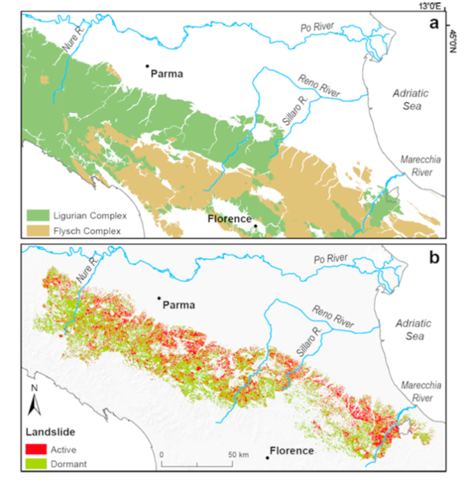
LASST focuses on the Aveto-Nure, Sillaro, and Marecchia river basins, intermontane fluvial systems of the Northern Apennines underlain, in variable proportions, by sedimentary lithologies of the Allochthonous Ligurian Complex (chiefly claystones) and the Flysch Complex (chiefly sandstones and marly flysch) (Fig.1a), and characterized by widespread landslide activity (Fig.1b). The location of these fluvial systems across the orogen in Emilia-Romagna (Fig.1) ensures that a spectrum of climatic settings is captured. Most importantly, since these rivers convey sediment to different types of water bodies, their sediment dynamics hold diverse and critical management implications, also in light of inherited anthropogenic impacts.
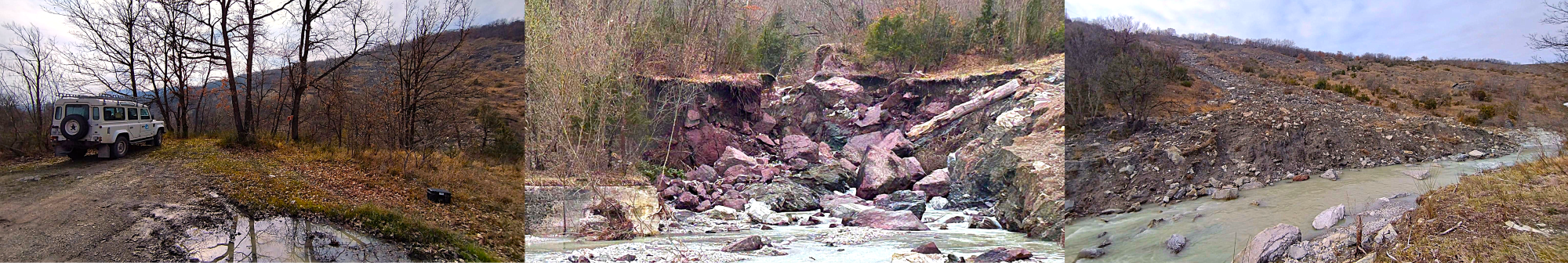
The Aveto-Nure River is an important source of sediment supply to the upper Po River and still today exhibits a rather natural hydromorphological state. Its headwaters have experienced intense mass-wasting activity during 2015 extreme flood events [1].
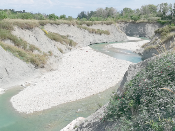
The Sillaro River transports sediment through a network of man-made canals to the Reno River, before reaching the Adriatic Sea (Fig.1). The Marecchia River flows directly into the Adriatic Sea and technically should supply sediment to the adjacent coast. However, due to a base level fall caused by a history of in-channel gravel mining, both the Sillaro and the Marecchia rivers have witnessed a sedimentary disequilibrium (i.e., canyon formation; Fig.2) and loss of significant sediment supply to the coast.
In all basins, available data include: (i) a 5m DEM, acquired before year 2008; (ii) aerial photosets and high-resolution orthophoto mosaics covering the 1954-2020 period; and (iii) bedrock and Quaternary geology mapping at 1:10,000 (CARG project). In the Aveto-Nure system: (i) a post-2015 (0.5m) LiDAR-derived DTM covering the river main stem and a 12 km² headwater tributary basin; and (ii) database of historical and recent debris-flow occurrences. In the Sillaro and Marecchia Rivers: (i) available LiDAR surveys (i.e., 2009 and 2019 in the Marecchia; 2021 in the Sillaro) covering the entire intermontane corridors and the adjacent valley sides; and (ii) historical mapping of planform channel changes (1954-2020). In addition, the Sillaro River can rely on: (i) a multi-temporal landslide inventory (1954-2018), which is currently in progress [2]; and (ii) sediment transport monitoring performed in one channel reach through UAV photogrammetric surveys and RFID particle tracking (since July 2020).
References
[1] G Ciccarese et al, Rend. Online Soc. Geol. Ital. 41: 127-130, 2016
[2] S Pittau et al, Rend. Online Soc. Geol. Ital., 54: 17-31, 2021